Ready for this?! Here are 11 of my favorite earth science apps and earth science websites for teachers! Lots of choices for your classroom.
Via Tom D'Amico (@TDOttawa)
Get Started for FREE
Sign up with Facebook Sign up with X
I don't have a Facebook or a X account


 Your new post is loading...
 Your new post is loading...
Your new post is loading...
Ready for this?! Here are 11 of my favorite earth science apps and earth science websites for teachers! Lots of choices for your classroom. Via Tom D'Amico (@TDOttawa) 
No comment yet.
Sign up to comment
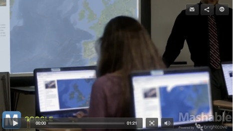
by Med Kharbach "Tour Builder is a cool web tool that allows users to create narrative stories using text, graphics, pictures, videos and Google Maps.Tour Builder lets you pick the locations right on the map, add in photos, text, and video, and then share your creation. Currently, Tour builder is still in beta version and it requires the Google Earth plugin which is only available for Windows and Mac OS X 10.6+" Via Tom D'Amico (@TDOttawa)
|
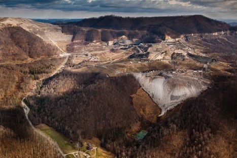
Exclusive: Landsat satellite images capture Earth evolving over 30 years. See climate change, glaciers melting, deforestation, urban sprawl Via Nik Peachey, Lilydale High School

Nik Peachey's curator insight,
June 7, 2016 4:22 AM
Amazing timelapse images to stimulate discussion and research in the classroom.
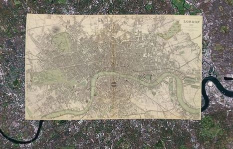
With 150,000 or so old print maps to his name, David Rumsey has earned his reputed place among the world's "finest private collectors." He continues to expand his personal trove as well as the digitized sub-collection he makes open to the public online — some 38,000 strong, and growing. He's created a series of interactive maps that layer old prints onto the Google Earth and Google Maps platforms, and this summer he plans to launch a geo-referencing tool (similar to one recently introduced by the British Library) that lets users get involved in the digital mapping process themselves. While preparing for this next expansion of his online map empire, Rumsey remains fascinated by "the power of putting these images up and letting them go," he says. "Maps have a way of speaking to people very straightforward," he says. "You don't have to have a lot of knowledge of map history or history in general. To me they're perfect tools for teaching history to the public." Via Lauren Moss
|