Research and publish the best content.
Get Started for FREE
Sign up with Facebook Sign up with X
I don't have a Facebook or a X account
Already have an account: Login

Science News
451.1K views |
+15 today

 Your new post is loading...
 Your new post is loading...
Your new post is loading...
Check out this artist's depiction of how a retired satellite's still usable antenna might one day be salvaged and turned into a new space asset as part of DARPA's Phoenix program. The goal of Phoenix is to develop and demonstrate technologies to cooperatively harvest and re-use valuable components from retired, nonworking satellites in GEO to create new space systems at greatly reduced cost. By robotically removing and re-using GEO-based space apertures and antennas from de-commissioned satellites in the graveyard or disposal orbit, space "junk" could become space "asset." More on DARPA: http://www.scoop.it/t/science-news?tag=DARPA 
Earth from Space is presented by Kelsea Brennan-Wessels from the ESA Web-TV virtual studios.
In this twenty-second edition of ESA's "Earth From Space," two images from from the Envisat satellite are examined, showing northern France and its urban heat islands.
DARPA's SeeMe program aims to give mobile, US warfighters overseas access to on-demand, space-based tactical information in remote and beyond-line-of-sight conditions. If successful, SeeMe will provide timely imagery to warfighters of their immediate surroundings via handheld devices. Articles about DARPA: http://www.scoop.it/t/science-news?tag=DARPA
From
phys

Satellite images have revealed that a network of ancient rivers once coursed their way through the sand of the Arabian Desert, leading scientists to believe that the region experienced wetter periods in the past.

From
urbmet
Two students unveil an interactive Web-based map that allows people to visualize energy use in specific neighborhoods in more than 40 American cities.
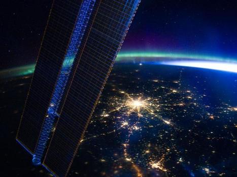
Moscow appears at the center of this nighttime image photographed by the Expedition 30 crew aboard the International Space Station, flying at an altitude of approximately 240 miles on March 28, 2012.

From
phys
A new study using satellite mapping technology reveals there are twice as many emperor penguins in Antarctica than was previously thought. ...

The irregular coastline of Kamchatka provokes large, circular eddies to spin off from the main southwestward-flowing Kamchatka current. Three such eddies are highlighted by surface ice floe patterns.

NASA's Tropical Rainfall Measuring Mission (TRMM) satellite provides a look at thunderstorms in three dimensions and shows scientists the heights of the thunderclouds and the rainfall rates coming from them, both of which indicate severity.
|

From a distance of 500 kilometers out in space, two German satellites equipped with special scanners are making a 3D map of the Earth's surface within an astounding accuracy of just two meters. Via Christine Hartmann
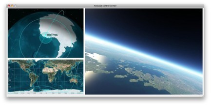
What would you do if you had one week to control a research satellite? The ArduSat (Arduino Satellite) utilizes state of the art Arduino Processors to process data from over 25 sensors, all housed within a 10cm x 10cm x 10cm CubeSat miniature satellite. Participants will be able to collaborate with others to formulate, test, and ultimately deploy publicly designed applications to run experiments. More on CITIZEN SCIENCE: http://www.scoop.it/t/science-news?tag=Citizen%20Science
http://www.ted.com In this short talk, TED Fellow Sarah Parcak introduces the field of "space archeology" -- using satellite images to search for clues to the lost sites of past civilizations.
This visualization tours the ocean floor from the gentle continental slopes to the deepest trenches using data analyzed and archived by NOAA. Does it look familiar? It is actually the same data that Google has incorporated into Google Earth and Ocean.
Aside from a couple particularly nasty collisions, dead satellites comprise the bulk of our planet’s space junk problem — as they die, get fried by radiation and become zombies, or are decommissioned, there’s nowhere for them to go. ViviSat aims to change that by servicing satellites where they are, pushing them into new orbits and allowing them to live longer.
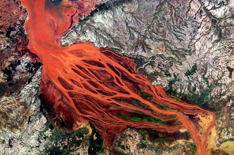
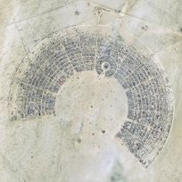
Patterns from space: beautiful satellite images of river deltas around the world.
Earth from Space is presented by Kelsea Brennan-Wessels from the ESA Web-TV virtual studios. In the twentieth edition we look at an image of the Juruá River snaking through the Amazon rainforest in western Brazil.
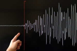
GPS networks could cut time needed for accurate alerts by a factor of ten.
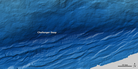
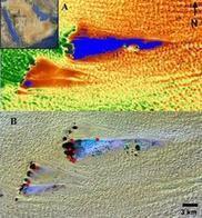
Oceanographers make new maps of the Mariana Trench that are 20 times better than anything before. ...
From
phys
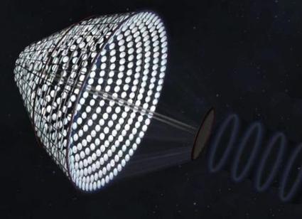
(Phys.org) -- Artemis Innovation Management Solutions has been given some seed money by NASA to look deeper into a project the company first proposed last summer; namely, building a satellite that could collect energy from the sun and beam it back down to Earth to add to the electrical grid. Articles about TECHNOLOGY: http://www.scoop.it/t/science-news?tag=technology

The lake between Israel and Jordan provides a bounty of salt and of history.
|
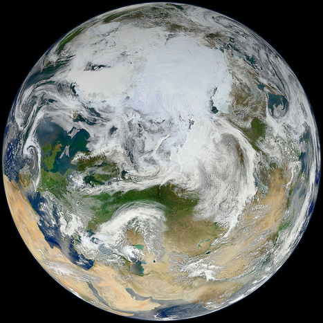
![[PHOTOS] 10 Years of Aqua Satellite’s Incredible Images of Earth From Space | Science News | Scoop.it](https://img.scoop.it/jBwMR2TFkq0NHfKDHeXwTTl72eJkfbmt4t8yenImKBVvK0kTmF0xjctABnaLJIm9)